Wired: Predictive Policing Software Terrible at Predicting Crimes

Crime predictions generated for the police department in Plainfield, New Jersey, rarely lined up with reported crimes, an analysis by The Markup has found, adding new context to the debate over the efficacy of crime prediction software.

Geolitica, known as PredPol until a 2021 rebrand, produces software that ingests data from crime incident reports and produces daily predictions on where and when crimes are most likely to occur…

Cambridge Day: Cambridge Police Launch their Justice Dashboard, Exploring Unequal Treatment by Showing Trends

The long-awaited Procedural Justice Dashboard, a major Cambridge police department project since 2019, has arrived after repeated delays from staff shortages and technological barriers. Unveiled Aug. 15, the dashboard appears to have kept many – but not all – of its promises to shed light on police interactions with the public and examine them for racial bias. At first glance, the dashboard shows some racial disparities in arrests and traffic stops.

For example, dashboard data covering the period starting in 2010 show that arrests of black people far exceed their share of the Cambridge population, and the gap between arrests of black people and white people has increased in the past two years though overall arrest numbers dropped sharply. As for traffic stops, over the past five years, the percentages of black and Hispanic drivers who received a criminal citation was more than twice the percentage of white drivers who were criminally cited…

The Globalization of Evidence-Based Policing: Innovations in Bridging the Research-Practice Divide (2022)

(Purchase) | (Request Review Copy)

Introduction

1. Evidence-based policing: Research, practice, and bridging the great divide 

Eric L. Piza and Brandon C. Welsh

(Version of Record) | (Open Access Post Print)

Part I: Transferring scientific knowledge to the practice community 

2. Globalizing evidence-based policing: Case studies of community policing, reform, and diversion 

Peter Neyroud 

(Version of Record) | (Open Access Post Print)

3. Developing evidence-based crime reduction skills in mid-level command staff 

Jerry Ratcliffe 

(Version of Record) | (Open Access Post Print)

4. Fits and starts: Criminology’s influence on policing policy and practice 

Nancy G. La Vigne 

(Version of Record) | (Open Access Post Print)

5. EMMIE and the What Works Centre for Crime Reduction: Progress, challenges, and future directions for evidence-based policing and crime reduction in the United Kingdom 

Aiden Sidebottom and Nick Tilley

(Version of Record)

Part II: Empowering officers to conduct police-led science 

6. From practitioner to policymaker: Developing influence and expertise to deliver police reform 

Richard Smith 

(Version of Record)

7. Creating a social network of change agents: The American Society of Evidence-Based Policing 

Heather Prince, Jason Potts, and Renée J. Mitchell 

(Version of Record)

8. Building empowerment: The Canadian approach to evidence-based policing 

Laura Huey and Lorna Ferguson 

(Version of Record) | (Open Access Post Print)

9. Evidence-based policing in Australia and New Zealand: Empowering police to drive the reform agenda 

Lorraine Mazerolle, Sarah Bennett, Peter Martin, Michael Newman, David Cowan, and Simon Williams 

(Version of Record)

Part III: Aligning the work of researchers and practitioners 

10. The LEADS Academics Program: Building sustainable police–research partnerships in pursuit of evidence-based policing 

Natalie Todak, Kyle McLean, Justin Nix, and Cory P. Haberman 

(Version of Record) | (Open Access Post Print)

11. The benefits and challenges of embedding criminologists in crime analysis units: An example from Sweden 

Manne Gerell 

(Version of Record) | (Open Access Post Print)

12. Non-traditional research partnerships to aid the adoption of evidence-based policing 

Stephen Douglas and Anthony A. Braga 

(Version of Record)

13. Data-informed community engagement: The Newark Public Safety Collaborative 

Alejandro Gimenez-Santana, Joel M. Caplan, and Leslie W. Kennedy 

(Version of Record) | (Open Access Post Print)

14. Surveillance, action research, and Community Technology Oversight Boards: A proposed model for police technology research 

Eric L. Piza, Sarah P. Chu, and Brandon C. Welsh 

(Version of Record) | (Open Access Post Print)

Part IV: Incorporating evidence-based policing in daily police functions 

15. Translating and institutionalizing evidence-based policing: The Matrix Demonstration Projects 

Cynthia Lum and Christopher S. Koper 

(Version of Record)

16. CompStat360: CompStat beyond the numbers 

S. Rebecca Neusteter and Chris Magnus 

(Version of Record)

17. Transitioning into an evidence-based police service: The New Zealand experience 

Bruce O’Brien and Mark Evans 

(Version of Record)

18. Statewide evidence-based policing: The example of the New York State Division of Criminal Justice Services 

Michael C. Green and Leigh Bates 

(Version of Record)

19. The Cambridge Police Executive Programme: A global reach for pracademics 

Lawrence W. Sherman 

(Version of Record)

Conclusion

20. Evidence-based policing is here to stay: Lessons learned and next steps 

Brandon C. Welsh and Eric L. Piza 

(Version of Record) | (Open Access Post Print)

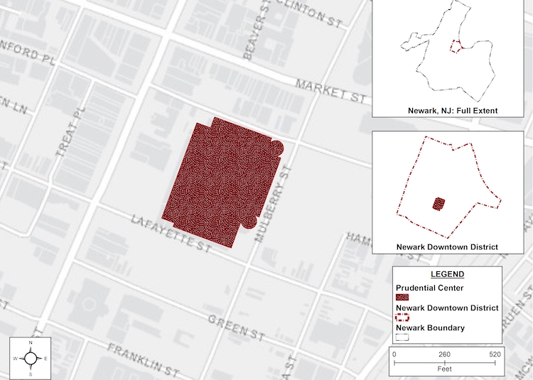
Evidence on the Impact of the Prudential Center on Crime in Downtown Newark

Gian Maria Campedelli, Eric L. Piza, Alex R. Piquero, and Justin Kurland (2023)

Journal of Experimental Criminology

Abstract

Objectives: Evaluate the effects that Prudential Center events had on crime in downtown Newark from 2007 to 2015 in terms of incident counts and spatial characteristics.

Methods: We evaluate the effects of events held at the Prudential Center on crime counts via negative binomial regression. Through the Fasano-Franceschini test, we assess whether crimes that occurred during events spatially differ compared to the incidents in no-event hours. Finally, we employ logistic regression to assess the correlation between crime locations and activity at the center.

Results: Five event types (out of nine) are statistically associated with increases in crime. Spatially, differences in the distribution of incidents when the facility is active partially emerge. Two out of six location types (streets and parking lots) correlate with activity at the center.

Conclusions: The complex array of crime-related effects that the center has on downtown Newark suggests tailored policies discriminating between event and location types for enhancing public safety.

Proactive Monitoring and Operator Discretion: A Systematic Social Observation of CCTV Control Room Operations

Eric L. Piza and Lauren N. Moton (2023)

Journal of Criminal Justice

*Data collection activities were funded by the National Institute of Justice (grant number 2010-IJ-CX-0026)

Key Takeaways

  • Targeted surveillances of known suspects were nearly 8 times longer than surveillances of persons unknown to the CCTV operators
  • Targeted surveillances of known suspects were 49% less likely to involve reasonable suspicion or probable cause
  • Female CCTV operators were 40% more likely than male operators to observe incidents of reasonable suspicion/probable cause
  • Female CCTV operators were over 4 times more likely than male operators to report incidents of reasonable suspicion/probable cause to patrol
  • Visible obstructions to the camera feed were associated with over 9-minute increases in surveillance length and an over four-fold increase in reporting likelihood

Research Summary

Technological advancements have allowed seamless integration of a range of surveillance technologies, making video surveillance a core component of daily police operations around the world. While the increase in evaluation research has provided insight into crime control outcomes associated with CCTV, many procedural and contextual considerations remain under-explored. Of particular importance is the lack of understanding of the human factors that drive surveillance interventions, and how decision-making processes influence the manner in which video surveillance translates to enforcement actions in the field. By and large, research has not analyzed how CCTV operators select which persons to observe or the factors that lead operators to report observed behavior to law enforcement.

The current study is a systematic social observation (SSO) of discretionary CCTV operator actions during the CCTV Directed Patrol Experiment in Newark, NJ. During all patrol shifts, the lead author and two research assistants observed the activity of the CCTV operators and actions of those being surveilled from within the CCTV control room. CCTV camera feeds were displayed on large monitors mounted on the control room walls, allowing the research team to easily view all activity. We coded field notes created by researchers during the SSO to build a database that allowed for a statistical analysis of each targeted surveillance—an observation of an individual or group of individuals lasting one minute or longer—conducted during the CCTV directed patrol experiment.

The analysis tests the effect a range of factors has on (1) the duration of targeted surveillances, (2) whether an incident providing reasonable suspicion and/or probable cause was observed by the CCTV operator, and (3) whether the CCTV operator reported any observed reasonable suspicion and/or probable cause to police. The average targeted surveillance lasted 16.52 minutes, with a standard deviation of 15.85 minutes. An instance of reasonable suspicion or probable cause was observed in 104 (46.22%) cases. Of these 104 cases, the CCTV operator reported the event to the patrol units in 72 instances (69.23%).

Fifty-five (24.44%) targeted surveillances observed a known suspect which may be credited to the focused nature of the intervention, as CCTV operators monitored the same cameras each tour of duty. Targeted surveillances of known suspects were nearly 8 times longer than surveillances of persons unknown to the CCTV operators, but 49% less likely to involve incidents of reasonable suspicion or probable cause. Female CCTV operators were 40% more likely than male operators to observe incidents of reasonable suspicion/probable cause and over 4 times more likely to report such incidents to the police. Operators with a supervisor rank were associated with over 3-minute decreases in targeted surveillance length, but a two-fold increase in observation of reasonable suspicion/probable cause. Visible obstructions to the camera feed were associated with an over 9-minute increase in surveillance length and an over four-fold increase in reporting likelihood.

These findings suggest that organizational culture, CCTV operator characteristics, and land usage of target areas may foster differential surveillance behavior across CCTV operators. As remote strategies for policing continue to expand internationally, the identification of factors that impact discretionary practices is critical.

The Daily Free Press: Boston Joins Program to Reduce Gun Violence Within the Next Few Years

Mayor Michelle Wu announced last Tuesday that the city of Boston aims to reduce homicide rates by participating in a new program that is designed to create Boston-specific strategies to address gun violence in the city.

The program, designed by the Violence Reduction Center of the University of Maryland, brought together experts from across the country to examine gun violence, street outreach interventions and policing methods and customize the best strategy for reducing gun violence within the city of Boston.

“Boston is one of the safest large cities in the country, and a national model, but even with historic lows of public safety incidents, we are committed to eradicating violence in every neighborhood,” Wu said in a press release.

The experts called in by the program gave speeches as a part of a three-day workshop to representatives from the Mayor’s Office, Boston Public Health Commission, Boston Police Department, Boston Public Schools and other entities.

Eric Piza, a professor of criminology and criminal justice at Northeastern University, was one of the experts that was asked to speak in the workshop to explain his research on problem-oriented policing to address gun violence “proactively.”

Gunshot Detection Technology Time Savings and Spatial Precision: An Exploratory Analysis in Kansas City

Eric L. Piza, David N. Hatten, Jeremy G. Carter, Jonas H. Baughman, and George O. Mohler (2023)

Policing: A Journal of Policy and Practice

*This study was funded by a grant from the National Institute of Justice (grant number 2019-R2-CX-0004)

Key Takeaways

  • GDT alerts occurred a median of 93 seconds before the first 9-1-1 call for service (CFS)
  • GDT alert locations were a median of 234.91 feet from the location reported via CFS
  • In more than 26% of cases, GDT and CFS were geocoded to different street segments that do not intersect, meaning that officers responding to the CFS location would be a meaningful distance away from where the gunshot occurred
  • Regression analysis findings suggest time savings and spatial precision decrease in cases more conducive to citizen reporting

Research Summary

Gunshot Detection Technology (GDT)  is expected to impact gun violence by accelerating the discovery and response to gunfire. GDT consists of networks of acoustic sensors that detect and identify the location of gunfire in real time. This can help generate police response to shooting scenes quicker than when gunfire is reported by citizen calls to 9-1-1. GDT should further collect more accurate spatial data, given gunfire locations are assigned to the coordinates measured by the acoustic sensors rather than addresses reported second hand by callers to 9-1-1. However, little research has focused specifically on the level to which GDT offers such benefits.

The current study is a partnership between a multi-university research team and the Kansas City, Missouri Police Department (KCPD). KCPD data systems were triangulated to identify gunfire events reported by both GDT and a 9-1-1 call for service (CFS), with 2,946 such incidents included in the analysis. The study focuses on the time savings and spatial precision offered by GDT as compared to CFS over the first nearly 5 years of the program (9/14/2012-5/9/2017). Time savings measures the number of seconds between the GDT alert and the first CFS reporting the same gunfire event. Spatial precision measures the linear feet between the location detected by the GDT alert and the location reported by the CFS.

GDT generated an average time savings of 125.44 seconds, with a median of 93 seconds. To contextualize this value, police respond to reported gunfire in a median time of a 223 seconds according to KCPD data. Following arrival on scene, EMS responses have a median of 78 seconds, and the median time to the nearest trauma center is 480 seconds. The 93-second time savings represents nearly 12% (93 of 781 seconds) of the response and travel time.

The average level of spatial precision was 433.91 feet, with a median of 234.91 feet. In more than 50% of cases, GDT and CFS locations were geocoded to different street segments. In more than 26% of cases, GDT and CFS locations were geocoded to different street segments that do not intersect, meaning that officers responding to the CFS location would be a meaningful distance away from where the gunshot occurred.

Regression models, which incorporated 18 variables that could theoretically influence the reporting of gunfire, identified situational characteristics that influence GDT performance. The pattern of statistically significant variables suggests time savings decreases in cases that are more conducive to citizen reporting. For example, multiple gunshots detected and ambient population were negatively related to time savings. This suggests that the additional noise generated by multiple gunshots and more people on-street to hear such noises may lead to citizens calling 9-1-1 quicker. A similar theme was found in the spatial precision analysis. Levels of shots fired CFS and firearm-related crime reported on the street segments were consistently associated with decreased spatial precision. The relative proportion of residential parcels on a street segment was negatively associated with spatial precision. Taken together, this suggests that residents of street segments with high levels of illicit firearm activity may be better positioned to identify the source of gunfire.

Albuquerque Journal: Study on ShotSpotter in Kansas City Finds ‘No Meaningful Change’ in Violence

ShotSpotter has been around for decades and, according to the company, has been implemented at one time or another in more than 130 cities nationwide. Although only a few years old in Albuquerque, numerous studies and surveys have been done on the technology and its effectiveness over the years. On its website, ShotSpotter described the system as, “By itself, it is not a cure-all.” “But when used as part of a comprehensive gun crime response strategy, it can contribute to positive outcomes for the police and the community,” according to the website. A study by a group that receives funding from ShotSpotter reported a 30% drop in assaults, including gun-related assaults, in St. Louis County after the system was implemented. The study also found the overall number of arrests were “unchanged” by the technology’s use. In addition, some community surveys have been favorable to the tech. But other research has found fewer benefits of Shotspotter, including a recently completed 15-year study of the program in Kansas City. Professor Eric Piza, director of Crime Analysis Initiatives at Northeastern University, began to study the ShotSpotter program there in 2019, where it had been in operation since 2012. The study considered crime data dating back to 2005, prior to ShotSpotter being implemented…

Drug Overdoses, Geographic Trajectories, and The Influence of Built Environment and Neighborhood Characteristics

Eric L. Piza, Kevin T. Wolff, David N. Hatten, and Bryce E. Barthuly (2023)

Health & Place

*This study was funded by a grant from the Bureau of Justice of Assistance and administered by the Institute for Intergovernmental Research

Key Takeaways

  • Group-based trajectory analysis classified block groups in Passaic County, New Jersey according to drug overdose trends from 2015 through 2019
  • A mixed-effects panel negative binomial regression model examined environmental and neighborhood characteristics associated with annual overdose counts
  • Block groups were classified across 3 groups: low and stable, low with moderate increase, and elevated and increasing
  • All but 1 of the elevated and increasing block groups were spatially contiguous within a single city
  • Concentrated disadvantage exhibited the largest effect size in the regression models
  • Most variables positively associated with overdose levels were built environment measures

Research Summary

Drug overdose has emerged as a national public health emergency in the United States over the previous decade. Prior spatial analyses have generated important insights into the problem of drug overdoses. However, spatial analyses of drug overdoses typically incorporate cross-sectional designs that are unable to measure the developmental trends of high overdose areas. Cross-sectional designs are further unable to account for within unit differences over time, which can bias estimates of independent variable effect. 

The current study sought to address gaps in the literature through a spatial analysis of drug overdoses in Passaic County, New Jersey from 2015 through 2019. This study is an outgrowth of an action research partnership between a multi-university research team and the Paterson, NJ Coalition for Opioid Response and Assessment (COAR). The mission of COAR is to develop data-driven, multi-agency responses to the overdose crisis in City of Paterson, NJ. COAR stakeholders anticipated county-wide resources would need to be mobilized to successfully address the opioid crisis in the Paterson. As such, COAR’s analysis efforts began with an assessment of overdoses throughout the entirety of Passaic County.

We first conducted a group-based trajectory analysis to classify block groups according to their overdose trends. To our knowledge, this is the first application of group-based trajectory analysis in the drug overdose literature. A mixed-effects panel regression model then identifies the built environment and neighborhood characteristics associated with overall overdose levels. Overdose data were provided by the New Jersey State Police (NJSP), which tracks state-wide drug overdoses as part of the national Overdose Detection Mapping Application Program (ODMAP).

The group-based trajectory analysis identified three groups with distinct drug overdose trends: low and stable (72% of block groups), low with moderate increase (24% of block groups), and elevated and increasing (4% of block groups). Areas in the elevated and increasing group accounted for the majority of overdoses with an average of 76.2 incidents over the five-year period. The year-to-year average in overdose events increased dramatically among this small number of block groups, from an average of 1.75 in 2015 to an average of 26.5 in 2019. The block groups in this trajectory grouping were highly clustered, with all but one spatially contiguous within the City of Paterson. This indicated overdose prevention resources could be highly focused within the geographies suffering from the most disproportionate levels of drug overdose.

In the regression analysis, concentrated disadvantage exhibited the strongest effect. This suggests that recent policy proposals to substantially increase investment in community institutions and general community wellbeing as a public safety strategy may also support overdose prevention efforts. Nonetheless, most statistically significant variables positively associated with overdose counts were built environment measures (liquor stores, health care facilities, vacant parcels, and public land parcels). These findings suggest certain types of land usage may provide targets for proactive social outreach efforts or may benefit from place-based policy solutions such as vacant lot greening.